A Journey of a Lifetime

Where do you start? How do you put the most epic journey of your life into words?
Well, perhaps I’ll start with the statistics and then tell you a story. Paint a picture of what led to the point where I decided to cross the country under my own steam, through some of the hardest and wildest terrain New Zealand has to offer.
I'm Tanya Bottomley. On 29 January 2022, I set off to cross the country on a human-powered mission from the west to the east coast of the South Island, using the 45th parallel south as my guide. The trip lasted 26 days, covered over 600km, with over 300km on foot, 22km of paddling and around 270km of cycling. But of course these numbers don’t tell the stories, the highs, the lows and the drama…and yes, there was drama!
But first, why did I decide to cross the country under my own steam? I value challenge, personal growth and adventure, and I absolutely love being out in nature. But there is something deeper there as well, a desire to push my boundaries to see what I am capable of. At my very core, I am a wild adventurer, I look at maps and get excited at the places I could go and the things I could see. When I look at those contour lines, I see possibility, excitement, hard work and ultimately an experience that I know will leave me a better person than the one who went into the trip. I will come out the other side stronger, wiser, more confident and with a deep feeling of gratitude and fullness of heart that only being wild can bring.

When I first devised this plan and started plotting the line across the country, I was scared. While I love the outdoors, challenging terrain sets off all sorts of alarm bells in my head and I often have to work through intense fears to achieve my goals. Fiordland, my chosen starting point, has some of the most rugged, remote and unforgiving terrain in New Zealand. It is mind-boggling in its scale and grandeur and not a place where too many people go off-track. My route through this beautiful and brutal terrain was to be all off-track, with some sections that have never been completed before.
So why choose something so hard, so off the beaten track? It was exciting to think that I would be forging a path where few had gone before me, and even fewer women. I have been through hard things in my life. The fact that I was even planning this trip felt somewhat miraculous to me. After leaving a long-term abusive relationship spanning over ten years, I was a shell of myself. If you had stood before me at that time and said I would be crossing the country while hiking, paddling and cycling, I wouldn’t have believed you. The relationship had left me with crippling PTSD, and the fearless girl I used to be had been turned into a woman crippled by anxiety.
Not one to let other people or circumstances define me, I have spent the last seven years rebuilding my life, my self-belief and overcoming fear. I got a second chance at life when I left that relationship and the wild adventurer that had been buried began to blossom. The traverse was a culmination of all the work I had done, and a signal to myself that I was strong enough and brave enough to forge my own path.

I spent hours pouring over maps and searching the internet for trip reports and information on the areas I would be covering. Somehow in the face of doubt from others that I could complete this trip, I found a deep well of belief and excitement. I just knew at the core of my being that I could do this, that no matter how hard the terrain I would find a way through.
It’s funny the way people talk about hard things as if discomfort is something to be avoided. I firmly believe that we all need to embrace challenging situations because overcoming challenges, in my opinion, is one of the most rewarding experiences life can offer. Hard times are simply part of the journey. To go and see extraordinary places comes at a price. You have to work for it, and if you do, you are rewarded with hallowed ground that few get to see or experience.
Trekking Caswell Sound Ridge to Glaisnock Hut
There is something quite surreal about being dropped by helicopter into the middle of nowhere. No track to follow, no one else around. As the rain fell steadily, the cloud rolled in around me, taking my vision down to mere metres in front of me. The thud, thud, thud sound of the helicopter retreated into the distance until I was engulfed in silence and the magnitude of the journey in front of me weighed heavy. Even with the weight of the unknown though, I felt a greater sense of excitement. Let the adventure begin!

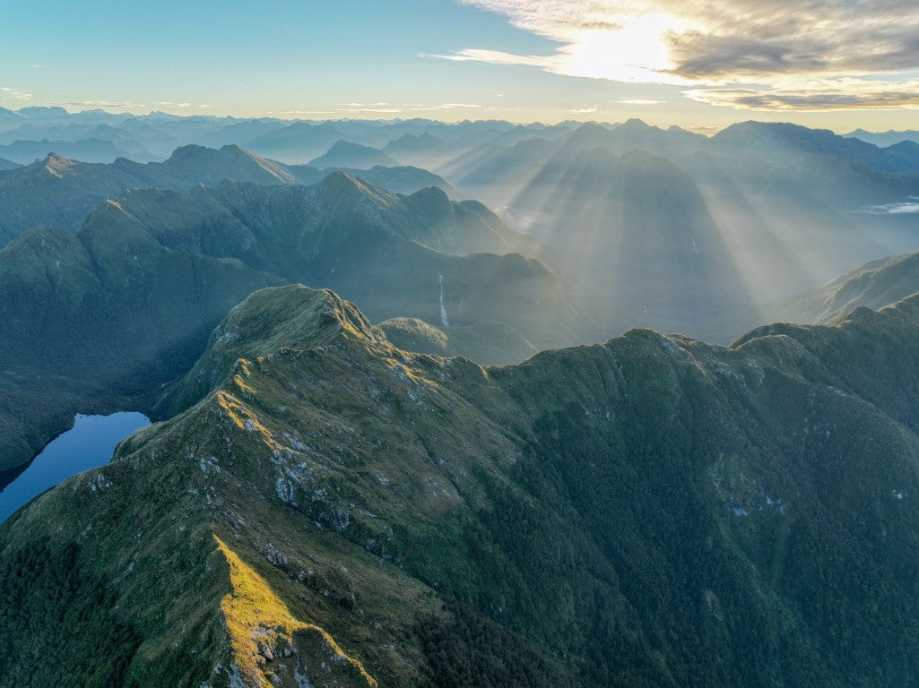
Fiordland pulled no punches and from the very beginning presented the most challenging but yet most mesmerising terrain. The grandeur of the mountains, which soared what seemed near-vertical into the sky, with the most magical hanging valleys. It was often not until I had travelled some distance that I could turn around and be awed by the hallowed terrain that I had just covered. Very few step foot in this country. It is rugged, brutal and unforgiving, but also the most beautiful, remarkable and rewarding country. Many tears were shed in Fiordland, tears of frustration, pain and fear, but also of joy, relief and wonder.
Each river, ridge and valley had its own distinct character. From the thick and unrelenting bush along the Stillwater River to the enchanted forest of the Wapiti River, with moss-covered boulders the size of houses and lush green bush. Bluffs and massive slips appeared before me at regular intervals, testing my strength and determination, my heart racing as I figured out how to climb up, down or around them. In Fiordland, it felt like I spent as much time hand-over-hand climbing up and down the steep terrain as I did pushing my way through ferns, leatherwood and bush lawyer. The cuts and scrapes on my arms, legs and face became badges of honour.
The intense relief as I ticked off each section was almost visceral, as scrambling up exposed sections of waterfalls or sidling vast, steep slips made me aware that placing one foot wrong could mean disaster. But those are the risks you take to travel in this terrain. For the most part, Fiordland terrain is steep but densely covered in bush, which means it can catch you when you fall (which I did, twice).
Paddling North Fiord and Lake Te Anau to Camp Bay and the Trek to End Peak
It was with trepidation that I stepped into my kayak to cross North Fiord and Lake Te Anau. The calm waters of the previous day when I arrived at the water's edge had been replaced with waves and wind and a forecast of rising winds. Water, my nemesis, has always instilled a deep primaeval sense of fear, and on this day the fear nearly got the better of me. The headwind roaring down the Fiord felt like an invisible force pushing me back to where I had come, challenging me with every stroke of my paddle.

But I was rewarded for my efforts with the most beautiful waterfalls crashing from the unforgiving terrain above me into the unfathomable depths of the Fiord. I was absolutely captivated by this place as much on the water as I was on solid ground. I edged ever closer to the lake, knowing that I would soon be trading my headwind for a strong crosswind and that the true battle with my fear of this powerful lake was about to begin.
I was gratefully supported on my paddle by Fiordland Outdoors. Before crossing Lake Te Anau, I was told the boat would cross beside me, blocking as much of the wind as it could. I simply had to “aim for the big rock on the other side, and just keep paddling”. With any luck, the crosswind would push me further up the lake towards Camp Bay, where my next trekking adventure would begin.
The waves rose and fell around me, and I paddled my heart out. About halfway across, I felt an intense pain in my right shoulder which increased with every stroke. I wanted to cry, to bail, to just not be there in that moment, which felt so close to overwhelming me. My breath quickened as an irrational panic started to set in. But there was nowhere to go, and I wasn’t going to get on the boat this close to my goal. The fact the boat was there gave me the courage I needed to continue. I paddled into the calm of the bay and enjoyed the change in wind direction which meant a tailwind helped carry me to the shore, where, with shaking legs and arms, I greeted solid ground.

That day wasn’t done with me yet though, as I decided to make a push for End Peak, some 1200 vertical metres above me. Little did I know I would be entering the contours of deception and the climb of despair. I had coined a phrase through my travels this far: ‘Fiordland, not what it says on the map!’ and that statement was no more true as I climbed through the bush to reach the summit. This was the kind of terrain where your compass is indispensable, as the map and the terrain simply don’t match up. Of all the places I had travelled on the journey so far, this would be the area it would be easiest to get lost in. The climb of despair came when, ascending above the bush line, I was greeted with scrub almost as tall as me, which made the final climb up the spur brutal on my weary body.
The wind on the tops was wild as I set up the tent in a perfect spot on the ridgeline, with the most stunning 360-degree views. It was when I was safely ensconced in the tent having my dinner that a message came through that I was to expect fierce gale force winds, which meant I needed to get off the tops. So, at 11.30pm I packed up the tent and headed down to find a clearing that would offer me shelter from the wind. Morale was low, the push to the top had been brutal and the planned ridgeline route tantalisingly close, but with severe weather warnings, there was no choice but to turn around and find another route through.
By this point, I had been going for 16 days. I had climbed near-vertical waterfalls, descended into vast boulder-strewn gullies, followed the most amazing animal trails and bashed and climbed through the thickest of bush. I had climbed up, down and around more bluffs than I could count. I was weary and my resilience was down. I coined a term for how I was feeling, ‘contour anxiety’, as things so often weren’t what it said on the map, and I wasn’t sure in my fragile, sleep-deprived state that I had the headspace to deal with the uncertainty as I continued the push through potentially another week of off-track navigation.
Trekking the East Eglinton River track to Mount Nicholas Station
The next few days were spent travelling the East Eglinton River, climbing to the most breathtaking saddle, descending into the valley through massive boulder fields and dense scrub following the Mararoa River, to finally trek into the relatively easy-going terrain of Mt Nicholas Station. There were lots of laughs, moments of frustration and sometimes bewilderment at the still seemingly endless bush bashing and intense navigation at a point where I thought the terrain would start to relent. Even so, I had gotten into a flow of moving through the bush, picking lines and more confidently navigating. There was so much beauty and brutality, but I was used to the ebb and flow now. Simply being in the moment knowing that each high and low would pass, and realising that this is simply the natural order of things. Sun and rain, howling wind and still, peaceful moments, extreme physical and mental exertion, followed by moments of relative and restorative ease. It was late in the evening as I trod on the first road in this trip into Mt Nicholas Station, aware that the true wild was done and I was mere days from the East Coast.

Mt Nicholas Station to Bannockburn: Via Cecil Peak, Wye Creek, Remarkables, Mt Rosa, Mt Difficulty
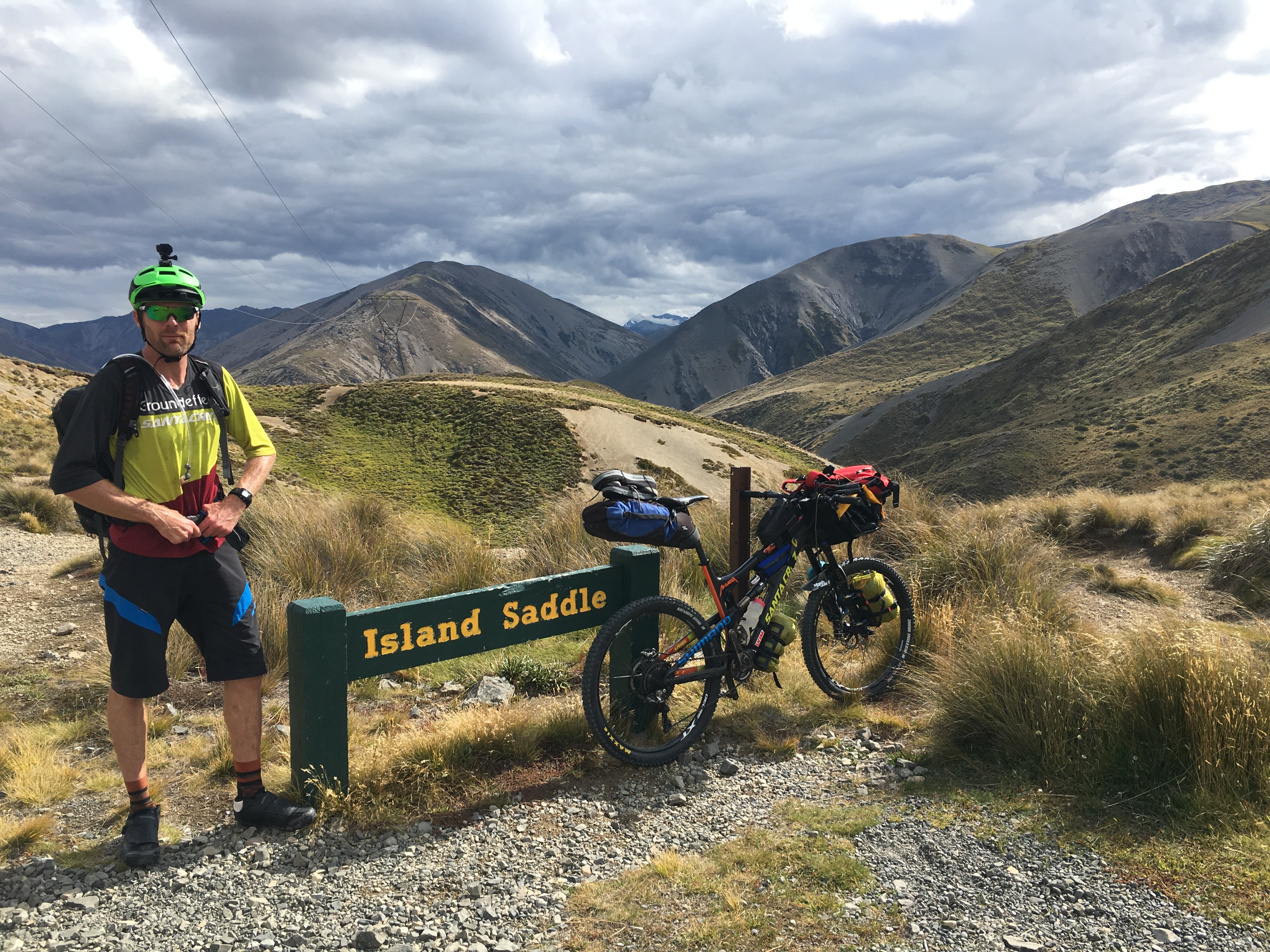
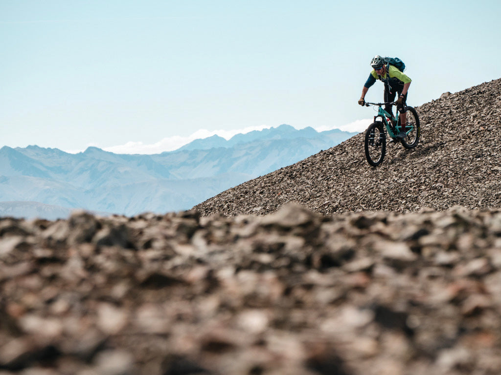
From Mt Nicholas Station through to Bannockburn I was in familiar territory. Open tops made navigation easy, but these were big days covering 40+ kms per day on a weary body. The terrain was completely different to Fiordland and I was climbing scree and slate bowls, scrambling along ridgelines, my rock climbing skills coming into play. A lack of water while crossing the tops from Wye Creek to the Nevis River nearly derailed the journey, reminding me that I needed to constantly adapt to the changing terrain.
From the high point of the spur overlooking the river, the gully across the river looked steep, unforgiving and impassable. The lesson learnt on this trip though is that things always look worse from a distance, and that there is always a way around. Crossing the Nevis River, which was still high from a storm that had passed through days before, was both a milestone and a challenge as I stood on the banks wondering if this fast-flowing river was going to be the end of the trip. I was delighted to find a way across the river, the fear and exhilaration leaving my legs shaking, and coming across strong animal tracks that lead up through the gully to the farm tracks that would lead me to Bannockburn and my bike.
Cycling Bannockburn to Oamaru
Bannockburn was a sight to see, though civilization was both a welcome but dreaded place. As anyone who has been in the bush for any length of time knows, there is the push and pull of civilisation that can weigh heavy on the heart of the adventurer. This point for me meant dropping my heavy pack, grabbing my bike and starting a new leg of the journey. As a relatively new mountain biker, I approached the Dunstan Trail with trepidation. I had received messages from helpful people telling me to be careful on the corners and that there were ‘high consequence cliffs!’ Ugh, just what I needed to hear with my brand new clip-in shoes attached to my pedals and a propensity for being fearful!

The Dunstan Trail was exciting, the cliffs were considerable, the bluffs spectacular and the journey thrilling. From Clyde, I joined the Otago Rail Trail which offered a largely flat and uneventful passage through to Kyeburn where I once again headed for the hills. The twists and turns of the expedition were not done yet though. As I arrived in a paddock at the base of the final trek after a 110+ km cycle with a headwind, I was informed that I didn’t have permission to be where I was. I considered my options, should I try to get landowner permission at 6pm with just a Garmin InReach for communications, or pick another route? A quick look at the maps and the route over Danseys Pass became an obvious alternative as a cycle rather than trek into Oamaru. It also meant another 30km back the way I had come on my bike to get to the campground on Danseys Pass.
The ride to the start of Danseys Pass began with the most amazing 7km of tailwind and I whooped and hollered my way back to Kyeburn enjoying my first and only taste of tailwind. However, turning the corner towards the pass it became apparent that the next 20km of cycling was going to be into a fierce headwind. I have to admit that was a pretty low point. I had run out of fuel and water, due to the extra 27km as an unexpected add-on to an already big day. The wind was unrelenting and the road was anything but flat as I headed into the pass. There was a quiet determination to grind out those kilometres with the knowledge that this would be the last night in the tent, as the traverse was one day from being complete.

The next day dawned as the last of the trip. No alarm, I cruised into the morning knowing I had another 80km to take me to the coast with a saddle to gain as I journeyed over Danseys Pass. The wind that had been with me for the previous days was determined to follow me to the end as I pushed through a crisp, cool morning in all my layers to gain the saddle. I spun up the hills and enjoyed the drama playing out in the sky, as rain fell, clouds billowed, and the wind chased them across the sky in a dramatic show, casting shadows and giving me glimpses of the valley below and the mountains around. I flew down the hills at speed with simultaneously a massive smile of excitement and an underlying sadness that today would be the last day of the trip, that in only a number of hours I would be dipping my toes in the ocean. The hills weren’t done with me yet though as I joined the Alps to Ocean Cycleway and the track undulated through farmland, tunnels, roadsides until finally, I hit the town of Oamaru.
“You can go your own way”. This song, which became a regular feature of the trip as I forged my own path through the wilderness, was blasting from my phone as I rode through the Oamaru Public Gardens. Standing up on my pedals, one fist in the air, singing at the top of my lungs, tears in my eyes, at the realisation that I had done it.

Coast to Coast along the 45th parallel south, it is a journey that still feels more like an unbelievable dream than a reality. I can still feel the cool dampness of climbing up the waterfall to Ethnie Saddle, my feet struggling to gain purchase on rotten trees, the dense bush dark around me, the smell of moss and earth. The most imposing bluff pushing me across the creek and up onto the saddle, the terrain somehow leading me to where I needed to go. The pure exhilaration and tears of joy when I looked at the map and realised I had finally, after eight hours, managed to negotiate approximately 2km down a steep spur coming off Camp Hill, after spending the night on a small ledge having run out of daylight to complete the descent. The heart-sinking realisation that on more than one occasion I had pushed too high in my navigation, taking me off course and the subsequent downclimbing that had me rooted to the spot in fear, not wanting to move forward as the sunlight poured through the trees overhead and a warm breeze made the leaves in the trees dance. Running along the ridgeline high above Caswell Sound singing the praises of the deer that left tracks that made my passage so much easier. So many memories, so many emotions, but prevailing above all else is gratitude and a deep understanding of the great privilege that I had to move across the country, powered by my body.
Follow Tanya's journey on Instagram.
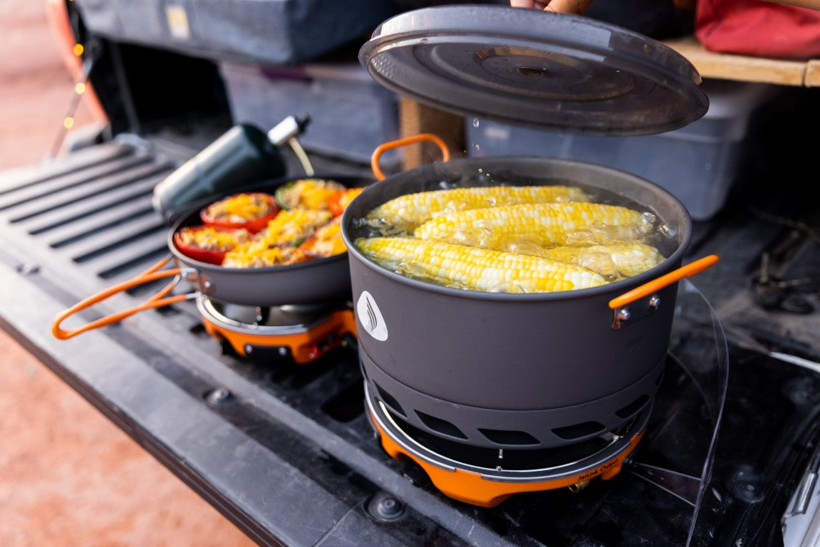
Tanya's go-to stove is the MicroMo.


